The water area figures include inland, coastal, and territorial water where applicable. Inland water consists of any lake, reservoir, pond, or similar body of water that is recorded in the U.S. Census Bureau's geographic database. It also includes any river, creek, canal, stream, or similar feature that is recorded in that database as a two-dimensional feature (rather than as a single line).
Land and water area measurements may disagree with the information displayed on U.S. Census Bureau maps and in the TIGER database because, for area measurement purposes, features identified as intermittent water are reported as land area. For this reason, it may not be possible to derive the land area for an entity by summing the land area of its component census blocks.
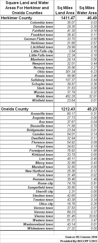
The table below shows the 2010 Census figures for the land and water areas of all municipal civil divisions (towns and cities) for Herkimer and Oneida Counties.