Thursday, June 27, 2013

Following The Changes to The North-South Arterial: Twitter, Facebook, and DOT Project Web Links

NYSDOT Region 2 is initiating a large scale public outreach for the North-South Arterial project. In doing so, they have launched a Twitter feed and an Arterial Facebook account to provide real-time updates regarding the project. In addition, the project website will have information available

Also, at this time construction is planned to continue through the Summer of 2016 but the DOT is anticipating keeping two lanes of road open both northbound and southbound for the duration of the project (albeit at a slow construction corridor speed). Updates, as well as pictures of the progress of the project, can be found on all of the above links!


2012 School Completion Data for Herkimer and Oneida Counties


According to the Utica Observer Distach, the New York State Education Department recently released its analysis of the 2011-12 graduation rates allowing district officials the chance to judge where they stand and assess changes that need to be made. This comes at a when rigorous graduation requirements were being phased in, school districts statewide held the line with 74 percent of students who started high school in 2008 graduating by June 2012 — the same as in the 2010-11 school year.

What is interesting to note are the drop-out rates. While these largely reflect exactly what you would think – namely students who have quit school without getting their diplomas – the term isn’t without definitional warts. It includes students that have bureaucratically fallen through the cracks.

Students who end up sometimes being referred to as “non-completers” include those that have legally stopped attending school. But it can also include students who haven’t been tracked properly when they have transferred to other districts. So if Billy transfers from School A to School B, and School A doesn’t change his status to note that he has transferred to another district, he will ultimately be lumped into the “drop out rate” of School A. While these types of snafus are hopefully minimal, they undoubtedly do occur, especially if Billy’s family has moved out of state.

Regardless of these quirks, the data for Herkimer County and Oneida County school districts can be found by clicking the links below.


Herkimer County High School Completion Data


Oneida County High School Completion Data

Median Household Income: New Maps Now Available!

Thanks to our GIS group for getting these maps together showing the median household incomes by block group within Herkimer and Oneida Counties ! Remember that block groups are as small as we can go geographically with most data. Block groups are basically sub-areas of Census tracts, so a tract might typically have any where from three to six block groups within it.

You can see the tract maps for both counties, as well as these many other types of maps (these median household income maps have just been added) on our MAPS page. If you're interested in some other income data, you might want to visit a previous post showing income and poverty measures by municipality for each county. You could also simply search using the search engine at the upper right of the Census Affiliate blog for all "income" related posts.

In the meantime, here are the maps for your perusal !
Click to Enlarge OC
Click to Enlarge Utica
Click to Enlarge Rome
Click to Enlarge HC
Click to Enlarge HC Valley


Wednesday, June 26, 2013

A Rose By Any Other Name: What State Names REALLY Mean

Cartographers Stephan Hormes and Silke Peust have created a U.S. map depicting the original, literal meanings behind the states and cities we know today. A version of the map is below. Who knew we were literally living in the "New Yew-Tree Estate" ? Now I have been to the "Islands of the Gods" several times, but next year I plan to visit the "Land Toward Which The Sea Flows". Track down some of your favorite states and places to visit!

Click to Enlarge

Population Projections: The Program on Applied Demographics at Cornell

I get a fair number of requests from people for population projections. Unfortunately, while we do occasionally dabble in these, the efforts we make remain unofficial. The State of New York, which has provided such things in the past, also doesn't have any "official" population projections. At present, the best place to probably look for this type of data is through the Program on Applied Demographics (PAD) at Cornell University.

PAD offers a variety of excellent data services and analysis, and works closely with both the Census Bureau and the NYS Census Data Affiliate Network. One of the things that they offer are population projections for every county in New York. The most recent version of their projections run through the year 2040, and offer breakdowns by age groupings, by sex, and by sex by age groupings.

Below are the two counties' population pyramids - basically a graphic representation of their population age distributions broken out by sex. The initial one in each series reflects the most recent census data from 2010. The successive pyramids are from PAD's projections for the years 2020, 2030 and 2040. Clicking on each will enlarge it to make it easier to see.

Herkimer and Oneida County Population Pyramids (click each to enlarge)

Herkimer County 2010 Census
Herkimer County 2020 Projection
Herkimer County 2030 Projection
Herkimer County Projection
Oneida County 2010 Census
Oneida County 2020 Projection
Oneida County 2030 Projection
Oneida County 2040 Projection

To see the actual data associated with each of these pyramids, be sure to visit the PAD population projection page.

Life Cycle of A Decennial Census: The 2020 Census Is Just Around the Corner

Recently there have been legislative efforts in Congress to dismantle much of the decennial census, as well as curtail the viability of the American Communities Survey. These have been covered in early blog posts. I thought it would be good to remind people that the 2020 Census is actually not that far away ! Yes, it is slightly less than 7 years until Census Day 2020 (officially it will be April 1 of that year), but the census doesn't just "happen" on that day. A lot of planning and preparation takes place well in advance of Census Day to make it be of value. It is that preparation which is currently facing potential difficulties with budgetary cuts, as well as legislative efforts which would severely hamper the data collection process.

So to better understand where we are and how cuts or legislative changes may impact a data collection effort that seems so far off, I wanted to remind  people of the life cycle of the decennial census. Terry Anne Lowenthal, of the Census Project Blog, has captured this life cycle rather well, and offers the following:

  • To begin, slightly less than seven years from now, census forms will be in the mail (or online or your smartphone or whatever latest gadget I’ll be too old to master).
  • In six years, field workers will be canvassing the nation’s streets, rural roads and remote dirt lanes to be sure all addresses are in the system.
  • Just five years down the road, the Census Bureau will submit the 2020 Census questionnaire to Congress; 
  • In four, it will send lawmakers the topics it will include on the form — both submissions are required by law.
  • In three years, Census staff will be mired in final, targeted research and testing of the 2020 design (using the American Community Survey, if lawmakers haven’t pulled the plug, as a primary cost-effective test-bed), operations development, and complex IT systems testing.
  • Next year (that’s 2014, folks), the agency will choose the basic design for the 2020 population count.
So as you can see, the effort to conduct the census every ten years doesn't just start during the tenth year ! It is a long arduous process that requires long term commitments as well as support. Alterations to that process make the collection in 2020 more tenuous as we go!

Tuesday, June 25, 2013

Getting at the Root of STEM Jobs: Expanding Our Vision of Science and Technology Workers

Workers in STEM (science, technology, engineering, and math) fields play a direct role in driving economic growth. Yet, because of how the STEM economy has been defined, policymakers have mainly focused on supporting workers with at least a bachelor’s (BA) degree, overlooking a strong potential workforce of those with less than a BA. Two previous posts to this blog talked about the types of degrees (science, technology, engineering, math and otherwise) the local workforce has, and the growth of the skilled trade workforce in our region. These are exactly the types of employees that are being talked about as STEM workers.

An analysis of STEM workers by Brookings finds:

  • As of 2011, 26 million U.S. jobs—20 percent of all jobs—require a high level of knowledge in any one STEM field. STEM jobs have doubled as a share of all jobs since the Industrial Revolution, from less than 10 percent in 1850 to 20 percent in 2010.
  • Half of all STEM jobs are available to workers without a four-year college degree, and these jobs pay $53,000 on average—a wage 10 percent higher than jobs with similar educational requirements. Half of all STEM jobs are in manufacturing, health care, or construction industries. Installation, maintenance, and repair occupations constitute 12 percent of all STEM jobs, one of the largest occupational categories. Other blue-collar or technical jobs in fields such as construction and production also frequently demand STEM knowledge.
  • STEM jobs that require at least a bachelor’s degree are highly clustered in certain metropolitan areas, while sub-bachelor’s STEM jobs are prevalent in every large metropolitan area. Of large metro areas, San Jose, CA, and Washington, D.C., have the most STEM-based economies, but Baton Rouge, LA, Birmingham, AL, and Wichita, KS, have among the largest share of STEM jobs in fields that do not require four-year college degrees. These sub-bachelor’s STEM jobs pay relatively high wages in every large metropolitan area.
  • More STEM-oriented metropolitan economies perform strongly on a wide variety of economic indicators, from innovation to employment. Job growth, employment rates, patenting, wages, and exports are all higher in more STEM-based economies. The presence of sub-bachelor’s degree STEM workers helps boost innovation measures one-fourth to one-half as much as bachelor’s degree STEM workers, holding other factors constant. Concentrations of these jobs are also associated with less income inequality. 
So maybe the root of creating and attracting more STEM jobs is recognizing the full breadth of who works in these fields, as well as what is required educationally in the full range of science and technology types of employment !


The Measure of America (and Herkimer and Oneida Counties): 2013-2014

In the era of “big data,” it would seem that policymakers and regular people alike would have the information they need at their fingertips to understand their world and make it better. Unfortunately, that’s far from the case. Though we know the country’s gross domestic product quarterly, its retail sales monthly, and stock market numbers minute-by-minute, we rarely hear statistics on our country’s people. How long can a baby born today in Missouri, New Mexico, or Minnesota expect to live? What proportion of adults have completed high school in Houston as compared to Dallas? What wages and salaries are typical of Latinos in the United States, and how do they compare to those of whites or African Americans?

The people at MeasureofAmerica.com have released their 2013-2014 report on exactly those items. Using what is called the Human Development Index, Measure of America looks specifically at three vital areas of human development — health, education, and earnings — and their impact on the opportunities available to us and how they enable people to invest in their families and live to their full potential. The Measure of America 2013–2014 contains American Human Development Index rankings for the 50 U.S. states and the District of Columbia, the 25 largest metropolitan areas, and racial and ethnic groups within those states and metro areas. It also looks at changes in well-being in states since 2000 and in metro areas before and after the Great Recession. Below is a screen shot of how each state (and the D of C) rank overall and with each of the three areas of human development.

Click to Enlarge
If you visit their mapping page, you can see some of these data mapped on the county level for the country, and of course, for New York as well. If you change you geographic level to county...

 
...and proceed despite the warning that pops up...


...you can look at any number of pieces of information on the county level.

In the end, you get access to a spatial graphic that looks like this (in this case for the income related index data):
Click to Enlarge
So play around a little and see how we measure up !

Monday, June 24, 2013

Fiscally Stressed Communities: NYS Comptrollers Designations FY2012

Two dozen communities in New York have been designated as fiscally stressed under State Comptroller Thomas P. DiNapoli’s new Fiscal Stress Monitoring System. The list includes eight counties, three cities and 13 towns, none of which are in our region.

DiNapoli’s monitoring system evaluates local governments on 23 financial and environmental indicators and creates an overall fiscal condition score. Indicators include cash-on-hand and patterns of operating deficits, together with broader demographic information like population trends and tax assessment growth. The scores are used to classify whether a community is in “significant fiscal stress", “moderate fiscal stress", “susceptible to fiscal stress,”or “no designation".

The municipalities found to be in stress share a number of common characteristics, such as low fund balance, a continued pattern of operating deficits and inadequate cash on hand to pay their bills. In addition to the 24 fiscally stressed municipalities, DiNapoli said 18 communities have been listed as “under review” and continue to have their information vetted. There are also 124 local entities that have been designated as “have not filed,” meaning they have yet to submit necessary financial information due to the Comptroller’s office. The remaining communities have been classified as “no designation.” This system measures the level of fiscal stress a municipality is facing. A municipality’s absence from the top three categories should not be viewed as substantiation of good financial condition by the Comptroller’s office.

 Here are the designations for our region.

Click To Enlarge

Oneida County Towns and Cities Median Ages

Last week I posted a piece about median ages in Herkimer County towns and the City of Little Falls. Here is the same data for Oneida County towns and cities. Note that I didn't put the numbers on the graph for the upper and lower bounds of the 90% confidence interval just to reduce the amount of visual clutter in contains. To see the actual confidence intervals you can look at the table at the bottom to see the actual numbers.

Several things stand out about the data. The median age for the county as a whole is 40.6 years of age in the 2011 five year ACS estimates. Based on that, two municipalities clearly have populations whose median age is significantly less than the county's. The first is the Town of Augusta, at 35.1 years old. The second is the City of Utica, at 35.2 years of age. In both cases, given their 90% confidence intervals, these two municipalities' populations are are statistically younger than the rest of Oneida County.

On the other side of the equation, we find significantly older populations in the following towns or cities: Forestport (52.3 years old), Marshall(45.2 years old), New Hartford(46.3 years old), Paris(46.4 years old), Sherrill(45.1 years old), Vienna(44.5 years old), Western(46.9 years old), and Westmoreland(43.7 years old).

Click to Enlarge

Click to Enlarge

Friday, June 21, 2013

Finding Local Daycare: The Child Care Council at Cornell Cooperative Extension

Finding good child care is undoubtedly one of the most important decisions parents make when faced with that needed service. Working in the child care profession is a demanding job that requires a great deal of patience, responsibility, and caring on the part of the workers. Locally the Child Care Council has a lot of great information about local child care openings, as well as job training opportunities. They are sponsored through Cornell Cooperative Extension.

According to the latest Equal Employment Opportunities data from the Census Bureau, there are roughly 309 people presently working in childcare jobs in Herkimer County, and about 1,310 people in the same line of work in Oneida County. Educationally, child care workers in Herkimer County are somewhat split between those with some college experience (48.5% have an associates degree or at least some college classwork) and those with only a high school diploma or less (46.6%). About 5% have bachelor's degrees among childcare workers in Herkimer County.

In Oneida County, more than half of the child care workers have a high school diploma or less (51.5%), while another 43.5% have either an associate's degree or some college course work. And as was the case in Herkimer County, 5% of Oneida County's child care workers have a bachelor's degree.

Below is an interesting infographic from the Census Bureau about national child care trends. Click to see it enlarged on the Census Bureau website for easier reading.

Child Care infographic image

June 21st: One of the Most Important Days Of The Year !

June 21st is one of the most important days of the year ? Why you may ask? Is it because of the summer solstice, perhaps? No, although we can always use a bit more sunshine! Two hundred and twenty five years ago today our Constitution was ratified by Congress.And while that alone is cause for celebration, it was the ratification of this living document that included (for me) one of the most important clauses of all within its hallowed words. 

Specifically I am speaking about Article 1, Section 2, of the Constitution which included the phrase:
[An] Enumeration shall be made within three Years after the first Meeting of the Congress of the United States, and within every subsequent Term of ten Years, in such Manner as they shall by Law direct.
Congress first met in 1789, and the first national census was held in 1790.
According to the USconstitution.net, there was actually some debate about whether, how, and on what timetable a census should have been held. In early 1790, several members of Congress argued against a census prior to the next election. Some in the Congress, who advocated an immediate census, noted that those who did not want one were the people from states which were generally regarded as being over-represented in the Congress based on the initial figures provided for in the Constitution. Others were concerned about the questions to be asked in the census, while others felt that more questions should be asked to get a better picture of the citizenry.
The final bill, Statute 2 of March 1, 1790, provided that census marshals and assistants be appointed. The marshals were directed to:
cause the number of the inhabitants within their respective districts to be taken; omitting in such enumeration Indians not taxed, and distinguishing free persons, including those bound to service for a term of years, from all others; distinguishing also the sexes and colours of free persons, and the free males of sixteen years and upwards from those under that age.
Here is a sample of what was in the 1790 Census form used for hand recording population data.
Click to Enlarge


The Census act directed that the names of the heads of families be recorded, the number of white males sixteen and older, the number of white males under sixteen, the number of white females, the number of all other free persons, and the number of slaves. Census day was set at the first Monday in August, 1790. Failure to cooperate with a marshal or assistant was punishable by a $20 fine.
Today, the controlling law for the U.S. Census is Title 13 of the U.S. Code That law required that the census be conducted on or about April 1, 1980, and every ten years after that. The returns must be made available within nine months in order to apportion members of the House of Representatives to each of the states. In the intervening years the law requires the Census Bureau to gather statistics about the residents of the United States for use by Congress. The law states that the count done in 1980 and every ten years thereafter shall be an actual headcount. The count done in the intervening years need not be an actual headcount, but may use statistical sampling methods to get a reasonable approximations of a head count.

So June 21st is a good day to celebrate more daylight, our Constitution, and the establishment of the US census!

Thursday, June 20, 2013

Town and City Median Ages in Herkimer County


So recently I have been posting about the various generational typographies and what life was like for each of the last three generations when they hit the age of 25. An undeniable truth is that our region is getting older!  Of course so is the rest of the country...it’s the aging of the Baby Boomers that’s presently driving our median age higher and higher among other things.

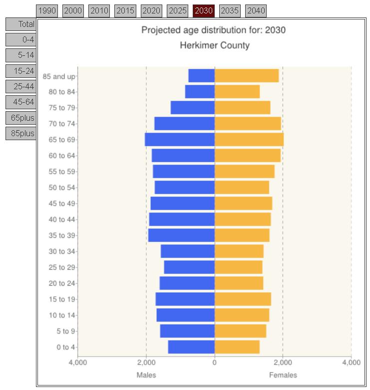
Of course when we hear that the current median age for Herkimer County is 42.0 years of age, we tend to think of that as being evenly distributed around the area. And generally speaking, that perception is fairly accurate. However, the distribution of our population based on age isn’t quite homogenous as one may think.

The graph below shows the median age for each of the towns as well as the city of Little Falls in Herkimer County. Each of the municipalities is shown with their median age (43.0, for example, for the Town of Columbia in Herkimer County) and then a 90% confidence interval has been depicted around that median age based on the margins of error supplied through the American Communities Survey. So in the case of the Town of Columbia, you can see that while the estimated median age is 43.0, we are 90% confident, based on the sampling, that the actual figure (if we were to survey 100% of the Town) would be between 46.3 and 39.7 years of age. Basically this is the same as saying that the estimated median age for Columbia is 43 years of age, +/- 3.3 years.

Click to Enlarge


So this same process has been used to look at all of the towns and as well as the City of Little Falls. So what does this tell us about the distribution of the population based on their median age then?

Well, in Herkimer County several things stand out. Three towns have populations that are considerably different from the county as a whole – namely the Town of German Flatts, the Town of Little Falls, and the Town of Webb.

German Flatts has a comparatively small confidence interval, spanning only +/- 1.4 years. In addition, German Flatts falls significantly below the median age of the rest of the county at 39.0 years versus the county median age of 42.0. This would suggest that German Flatts has a statistically younger population than the rest of the county.

In much the same way as German Flatts is younger than the rest of the county, the Town of Little Falls is significantly older than other parts of Herkimer County. Again, comparing the Town’s median age of 46.7 to the County’s 42.0, even with the Town’s median age confidence interval of +/-3 years of age, Little Falls is statistically older than the rest of the county.

The clear outlier, however, is the Town of Webb! The median age in the Town of Webb is 57.9 years of age – nearly 16 years higher than the counties. No other municipality even falls within the range of its 90% confidence interval (it stretches from 52.5 years of age to 63.3). Undoubtedly this has to do with many things unique to the Town, including its attraction to retirees.

Here's a table that gives the median age, upper and lower bounds of the 90% confidence interval and, for each town and the City of Little Falls in Herkimer County. Note on the above graph which places over lap and which do not !

Click to Enlarge

Tuesday, June 18, 2013

NPR: Why Women Outlive Men From Conception to Centenarianism

According to an article from National Public Radio, the 19th century just lost its last living man. He was Jiroemon Kimura, of Kyotango, Japan, who was born in 1897, and was 116 when he died. According to the Guinness World Records, he was the last surviving male born in the 1800s. All the other boys from that century, as best we know, have passed on. The ladies, however, are still ticking. Misao Okawa of Osaka is now officially the oldest person on the planet. She was born in 1898. There are four others — two in Britain, one in the USA, and another in Japan — all 19th century-born, all female, all still alive.

Once again, the ladies have outlasted the gentlemen. Not that that's a big surprise. Women, on average, seem to take a little longer to die. But here's an interesting fact: Women, it turns out, don't just win in the end. It seems that women consistently outlive men in every age cohort. Fetal boys die more often than fetal girls. Baby boys die more often than baby girls. Little boys die more often than little girls. Teenage boys, 20-something boys, 30-something boys — in every age group, the rate of death for guys is higher than for women. The difference widens when we hit our 50s and 60s. Men gallop ahead into eternal rest, then the dying differential narrows, but death keeps favoring males right to the end.

So Death, it turns out, is not an equal opportunity avenger. It seems to consistently favor males. Why? What is it about maleness that brings Death knocking? Well you'll have to read the article linked above to learn more about the hypothesis of "male weakness".

In the meantime, Herkimer and Oneida Counties combined had 65 people who were 100 years or older according to the 2010 Census. Of those, less than one out of every five (18%) of our centenarians were men.

Utica: The Town That Loves Refugees

A recent article in Refugee Magazine (download it here as a pdf) touts Utica as the "Town That Loves Refugees". Refugee magazine is published through the Office of the United Nations High Commissioner for Refugees.

According to the Utica Observer-Dispatch, a Zogby Analytics study looked into how Utica has become synonymous with welcoming foreign-born populations that have streamed into the city. It also suggests that the attraction of refugees is a situation that is unique to the region. The Community Foundation of Herkimer and Oneida Counties Inc. funded the $50,000 study. About $30,000 went toward conducting the study, with the rest of the money going toward efforts and recommended improvements cited in the study.

Here are several of the main findings in a Zogby Analytics study about why Utica is such a welcoming city for new populations:
  • The Mohawk Valley Resource Center for Refugees, though not the sole organization that caters to immigrants and refugees, is prominent in the community as the main resource for those populations.
  • The area’s history of assimilating other immigrant groups, such as the Irish and Italians, provide a base for welcoming new immigrant populations.
  • Though the Refugee Center has relationships with several area agencies that serve refugees, better communication and collaboration among those serving this population was cited as a need..
  • Local places of worship have embraced much of the refugee community, offering them spiritual guidance as they settle into the area.
To see where our refugee populations are coming from, you might want to look at the table on this previous post about refugees in Utica.

Monday, June 17, 2013

Bullying At Home Just as Harmful as Within Social Settings

A new study just released in the Journal of Pediatrics confirms that bullying is a problem for childhood development whether it take place in social settings such as schools, or even within families. As the new research points out, just as with peer bullying, sibling bullying is also harmful to a child or teenager’s mental health.

“Historically, sibling aggression has been unrecognized, or often minimized or dismissed, and in some cases people believe it’s benign or even good for learning about conflict in other relationships,” says Corinna Jenkins Tucker, lead author of the paper and an associate professor of family studies at the University of New Hampshire. “That’s generally not the case in peer relationships. There appears to be different norms for what is accepted. What is acceptable between siblings is generally not acceptable between peers.”

Tucker’s report used data from The National Survey of Children’s Exposure to Violence, a phone survey that collected the experiences of 3,599 children aged 1 month to 17 years who had at least one sibling younger than 18 living in the household at the time of the interview.  The interviewers asked about incidences of sibling aggression in the past year, and they also assessed mental health by asking how often the children experienced anger, depression and anxiety. Where children were too young to answer questions, parents were asked to complete the survey/interview.

Bullying has been a topic of interest in the local Teen Assessment Project (TAP) surveys which can be found on the Human Services Planning page on the County webpage. While the Herkimer County 2013 TAP survey  will be released by the Fall of this year, the most recent survey results covering bullying are in the 2011 Oneida County TAP report. Below is the table provided which points out how bullying has declined among teens over the past decade or so.

Click to Enlarge

Updating Addresses: Why We May Not Get A Chance To Be Counted Fully In The 2020 Census

Besides recent efforts in Congress to drastically change the nature of the decennial census as well as the American Communities Survey (see this previous post), there maybe be another hitch-in-the-get-along when it comes to being fully counted in the 2020 Census. The Census Bureau is presently considering changes to its Local Update of Census Addresses (LUCA) program, which serves as the ONLY opportunity that local communities have to provide review and input into the Census Bureau's master address file.

LUCA involves local communities reviewing the master address file for inaccuracies - incorrect addresses as well as missing addresses from the file that serves as the basis for mailing out the census forms. In the past this opportunity has been made to every single community; however, the Census Bureau is now considering offering the chance to review and update these addresses to only "targeted" areas that have been traditionally hard to get responses from. This may mean that many communities would not be in a "targeted" area and hence would lose out on a chance to improve their counts while other communities will reap the potential benefits.

To give this some perspective, in the 2010 Census, our office reviewed some 105,000 addresses in the two county region; we submitted some 17,000 address changes or new addresses that were missing from the master address file; and in the end some 11,000 addresses were added to the Census Bureau's files for our area. That is more than 10% of our region addresses that were added in as a result of LUCA. Assuming an average household population of 2.39 people, that translates into as many as 25,000 people that may have been found that would have otherwise been missed if we weren't part of the LUCA program. Below are two maps showing the block level increases in addresses as a result of our LUCA effort.
Herkimer County LUCA
Oneida County LUCA
This potential change in how LUCA is conducted could have HUGE implications for our next Census counts in 2020.

Friday, June 14, 2013

Circular Area Profiles: Getting Data Within A Set Distance From An Address

The very talent people at the Missouri Census Data Center (MCDC) are presently offering a GREAT tool for assembling data for an area in concentric circles around a specific location. In other words, say you want to locate a business at a specific corner in the City of Utica. You can use this tool to give you demographic, economic, social and housing profiles within a given radius (say within 5 miles) of that corner. Previously Census 2000 tools have been able to provide  this, but this is the first one I have seen that works now with both the 2010 Census as well as the most recent five year American Communities Survey data from 2011.

The "circular area profiles," as the MCDC is calling them, requires a user to input the latitude and longitude of the location being targeted, along with a few other minor things like giving the circular area a name, etc., in order to generate the profiles. So say we wanted to know about an area within 5 miles of the SUNYIT Campus in Marcy. The website provides a Google map application which allows you to type in the address of the location you are interested in and gives you the coordinates for that point. The lat-long coordinates for SUNYIT are 43.135118 and -75.229109, for example. If you type these coordinates into the appropriate boxes and then select a ring of 5 miles, you can then generate all sorts of information about the local population. The tool also allows you to pick multiple distances from the same point, so you could ask for data at a 5 mile, 15 mile, and 25 mile circle, all at the same time. Here is just a tip-of-the-iceberg sample:


The program is a beta level test project at the moment so it may still have a few kinks. But the good people at the MCDC deserve a heap of credit and a bushel of thanks for their fine work on this project !

Thursday, June 13, 2013

Internet Use and Connectivity in the US


In 2011, more Americans connected to the Internet than ever before, although differences continued to exist between those with use and those without. Just as with differences in use, variation in the ways that people were connecting online and the frequency of their use remained prevalent as well. A recent report of the Census Bureau, Computer and Internet Use in the United States, provides household and individual level analysis of computer and Internet use. The findings are based on data collected in a July 2011 supplement to the Current Population Survey (CPS), which includes questions about computer ownership, Internet use both inside and outside the home, and the additional devices that people use to go online. The U.S. Census Bureau has asked questions in the CPS about computer use since 1984 and Internet use since 1997.This narrative report is complemented by a detailed table package that allows users to explore the data in more detail.
 
One of the more interesting pieces of the report deals with how connected people are with their devices. Access to computing technology and the Internet is not a simple “yes/no” proposition. As technology has changed and evolved over the years, people have seen an increase in the variation and number of ways they use computers and access the Internet. To explore this phenomenon further, a scale was developed for use in the report, designed to place individuals along a “connectivity continuum” of access variations, ranging from people with no Internet connection or computer, to those connecting from multiple locations and devices. The result is the following graphic – please be sure to note the percents in parens after each level of the continuum. These are the national sample percentages of people at this level of connectivity.
 
Click to Enlarge

In 2011, a plurality of Americans connected to the Internet from multiple locations and multiple devices (27.0 percent). These individuals were considered “high connectivity” individuals. The second most common position on the continuum was the opposite extreme—individuals without any computer or Internet activity at all (15.9 percent), or “no connectivity” individuals. The remaining 57 percent of Americans were located somewhere between these two extremes.

What surprised me in this report was the map below. It shows the percent of the population having high connectivity access. Basically states are broken into three classifications – those who have a significantly higher percentage of their population with high connectivity access than the national average (which was 27%) by the way); those who didn’t vary significantly from the national average; and those states that had a significantly lower percentage of their population having high connectivity access.


Click to Enlarge


As the report notes, “The majority of southern states lagged behind the nation in terms of highly connected individuals. The same can be said for segments of other regions, as pockets of the West, Midwest, and Northeast all contained multiple states with low percentages of high connectivity...” Unfortunately one of those states is New York ! Apparently we are working at a significant disadvantage when it comes to high  levels of connectivity to the internet.